DJI Terra Flagship Permanent
by DJIDJI Terra is 3D modeling software equipped with next-generation reconstruction technologies, including 3D Gaussian Splatting.
- Ratenzahlung Sie können auf Raten mit den Visa, Visa Premium, Maestro, Master Card und Diners reditkarten zahlen. Die Gebühr beträgt 5% des offengelegenen Preises und wird im Warenkorb bei der Zahlungsauswahl gerechnet. Sie können mehr Details auf dem Link Zahlungsarten überprüfen.
- Schnelle Lieferung Für alle Lieferungen innerhalb Kroatiens, die bis 14.00 Uhr erhaltet werden, wird die Lieferung binnen einem Arbeitstag geliefert. Für die ganze Europa nehmen wir die schnelle Zustellung vor und mehr Details können Sie auf dem Link Lieferungsarten überprüfen.
- Internationaler Kauf Die EU-Firmen (außer die Republik Kroatien) zahlen den Preis ohne die Mehrwertsteuer mit dem gültigen VAT ID- Nummer. Der Preis wird bei Check-Out gerechnet. Alle Käufer außerhalb der Europäischen Union zahlen den Ausfuhrpreis ohne die Mehrwertsteuer.

Paket beinhaltet
- DJI Terra - Flagship - Permanent × 1
DJI Terra is 3D modeling software equipped with next-generation reconstruction technologies, including 3D Gaussian Splatting. It supports accurate and efficient 2D and 3D reconstruction from visible light imagery, and processes data collected by DJI LiDAR.
When integrated with DJI drones and DJI Modify, Terra delivers a unified hardware and software solution for data acquisition, processing, and application, streamlining aerial surveying workflows for greater efficiency and accuracy.
Digitize the World with Unmatched Accuracy
DJI Terra is a comprehensive software platform designed to convert drone-captured data into precise 2D and 3D models. Packed with next-gen features like Gaussian Splatting, LiDAR point cloud processing, and multispectral mapping, Terra empowers professionals across surveying, construction, agriculture, and infrastructure industries with the tools they need to build rich, high-quality digital environments faster and more efficiently.
Next-Level 3D Modeling with Gaussian Splatting
Experience cutting-edge modeling capabilities with Terra’s Gaussian Splatting engine. Create visually rich 3D reconstructions with lifelike detail that accurately replicate scenes containing intricate geometry, glass, reflective surfaces, and vegetation.
- High-Speed Processing: Handles 500+ images per hour
- Large-Area Reconstruction: Scale up to 30,000 images per job
- Runs on Entry-Level PCs: Only 4 GB GPU & 32 GB RAM required
Accurate Photogrammetry for Professionals
Generate survey-grade orthomosaics, DSMs, and 3D meshes with ease. Terra offers flexible control over model detail and map resolution and supports export in multiple industry-standard formats for integration with GIS, CAD, and modeling platforms.
- No Ground Control Points Needed
- Supports DJI RTK Drones for 1:500 Accuracy
- Real-Time Results in the Field for Smaller Sites
Precision Agriculture Mapping
Use data from multispectral drones like the Mavic 3 Multispectral or Phantom 4 Multispectral to create NDVI, NDRE, and prescription maps for smarter farm management. Ideal for optimizing crop spraying and analyzing vegetation health.
- Reflectance & Radiometric Output
- Customizable Crop Type Settings
- Direct Integration with DJI Agras Drones
LiDAR Data Processing & Fusion
Unlock the full potential of DJI’s LiDAR systems by merging 3D point clouds with visible-light imagery for highly accurate models of complex infrastructure. Terra supports RTK and PPK workflows for centimeter-level positioning without GCPs.
- Supports Bridges, Substations, Utility Corridors
- Process Up to 120 GB of Point Cloud Data with 32 GB RAM
- Flight Route Planning from 3D Models or External Dana
Cluster Processing for High-Efficiency Workflows
When speed and scale matter, Terra’s cluster functionality lets you distribute processing across multiple machines. Build massive 3D maps from 30,000+ images in under a day with just five worker nodes.
- Scaleable Workflows with More Nodes
- Optimized for High-Volume Projects
- Ideal for Smart Cities and Civil Engineering
Total Compatibility with DJI Ecosystem
DJI Terra integrates seamlessly with DJI Enterprise drones like Matrice 400, Matrice 4E, Zenmuse L2, Zenmuse P1, and D-RTK 3 to deliver a fully unified hardware and software surveying solution.
- Pair with DJI Modify to polish and post-process your models with tools for:
- Noise filtering
- Point cloud smoothing and downsampling
- Terrain modeling
- Export to industry platforms (GIS, CAD)
| Feature | Flagship |
| Agricultural Application | √ |
| 2D Map Reconstruction (Field/Fruit Tree) | √ |
| 2D Map Reconstruction (Urban) | √ |
| 2D Multispectral Reconstruction | √ |
| 3D Mesh Reconstruction | √ |
| LiDAR Point Cloud Reconstruction | √ |
| Terrain Result | √ |
| Gaussian Splatting | √ |
| Electricity Application | √ |
| Cluster Computation | x |
| Bind Device | 1 device |
| Authorization Mode | Online |
| Validity Period | Permanent |
- Neu
- Neu
- -20%Neu
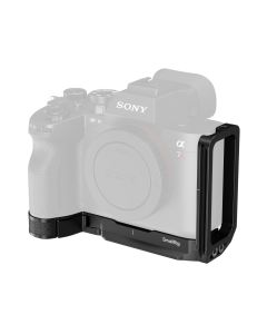 SmallRig L-Shaped Mount Plate for Sony Alpha 7R VI 6706Normalpreis 60,50 € * Minimal price in last 30 days Sonderangebot 48,00 € 38,40 €