DJI Zenmuse L3 (EU) SP Plus
by DJIDJI's next-generation high-accuracy aerial LiDAR system features a long-range LiDAR capable of reaching up to 950 m even on objects with just 10% reflectivity.
- Ratenzahlung Sie können auf Raten mit den Visa, Visa Premium, Maestro, Master Card und Diners reditkarten zahlen. Die Gebühr beträgt 5% des offengelegenen Preises und wird im Warenkorb bei der Zahlungsauswahl gerechnet. Sie können mehr Details auf dem Link Zahlungsarten überprüfen.
- Schnelle Lieferung Für alle Lieferungen innerhalb Kroatiens, die bis 14.00 Uhr erhaltet werden, wird die Lieferung binnen einem Arbeitstag geliefert. Für die ganze Europa nehmen wir die schnelle Zustellung vor und mehr Details können Sie auf dem Link Lieferungsarten überprüfen.
- Internationaler Kauf Die EU-Firmen (außer die Republik Kroatien) zahlen den Preis ohne die Mehrwertsteuer mit dem gültigen VAT ID- Nummer. Der Preis wird bei Check-Out gerechnet. Alle Käufer außerhalb der Europäischen Union zahlen den Ausfuhrpreis ohne die Mehrwertsteuer.

Paket beinhaltet
- Zenmuse L3
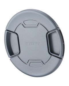
- Lens Cap
- CFexpressTM Memory Card (1 TB) × 2
- Zenmuse L3 Single Gimbal Connector
- Card Reader
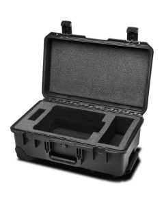
- Zenmuse L3 Storage Case
- Lens Cleaning Cloth
- DJI Matrice 400 Carrying Case Insert (Zenmuse L3)
- Zenmuse L3 Single Gimbal Connector
- Screws and Tools
- Zenmuse L3 Gimbal Damper (4 pcs)
DJI's next-generation high-accuracy aerial LiDAR system features a long-range LiDAR capable of reaching up to 950 m even on objects with just 10% reflectivity. Dual 100MP RGB mapping cameras and a high-precision POS system accelerate geospatial data acquisition, enabling daily coverage of up to 100 km².
Hardware Performance Redefined
Zenmuse L3 integrates a 1535nm long-range LiDAR, dual 100MP RGB mapping cameras, a high-precision POS system, and a three-axis gimbal, all within a compact device, delivering unprecedented performance for its size.
1535nm Long-Range LiDAR
Long Range, Wide Coverage
Zenmuse L3 achieves a maximum detection range of 950 m at a pulse rate of 100 kHz, tested under 100 klx ambient light and on objects with 10% reflectivity. The adjustable pulse rate allows for flexible power output and optimal adaptation to different operational scenarios. Typical flight altitudes of 300 to 500 m significantly expand single-flight coverage and boost mapping efficiency.
Small Spot, High Energy
With a laser beam divergence of just 0.25 mrad (1/e²), the spot size at the same range is about one-fifth that of Zenmuse L2, enabling detection of smaller objects such as power lines and branches. Higher energy density results in stronger penetration capability, significantly increasing ground point density beneath vegetation and enabling high-accuracy reconstruction of complex terrains and structures.
High Pulse Rate, Multiple Returns
With maximum laser pulse emission frequency of 2 million pulses per second and support for up to 16 returns, Zenmuse L3 delivers highly accurate spatial reconstruction. Point cloud density and penetration capability can be adjusted to fit needs from high-accuracy mapping to complex environments.
Scanning Modes
Supports Linear, Star-Shaped, and Non-Repetitive scanning modes for different operational scenarios:
• Linear: Achieves more consistent point cloud distribution, ideal for high-accuracy terrain mapping.
• Star-Shaped: Balances accuracy with multiple scan angles and penetration capability, well-suited for forests or dense urban environments.
• Non-Repetitive: Provides multiple scan angles and broader coverage, optimized for power line inspections and other complex structural surveys.
Dual 100MP RGB Mapping Camera System
Dual 100MP RGB Mapping Cameras
Equipped with dual 100MP 4/3 CMOS RGB sensors and a mechanical shutter, Zenmuse L3 delivers significantly enhanced accuracy and efficiency. Pixel binning supports an effective 25MP resolution with larger pixel size, producing superior color reproduction even under poor lighting conditions.
107° Ultra-Wide FOV
The dual RGB mapping cameras provide a horizontal field of view (FOV) of up to 107°, allowing each capture to cover a broader area. Even with a 20% LiDAR side overlap ratio, you can capture data for both digital orthophoto maps (DOM) and digital elevation models (DEM) in a single flight, thereby greatly improving operational efficiency.
Accuracy Meets Efficiency
Zenmuse L3 delivers significant improvements in both point cloud and RGB accuracy, while raising efficiency to new heights. Paired with DJI Matrice 400, a single flight can cover up to 10 km², enabling up to 100 km² of high-accuracy mapping per day. Large-area, high-accuracy results are delivered in a seamless workflow.
High Accuracy
Proprietary High-Precision System
The upgraded high-precision POS system achieves heading accuracy of 0.02° and pitch accuracy of 0.01° (post-processed, 1σ). The self-developed LiDAR delivers ranging repeatability of 5 mm at 150 m (1σ) and supports microsecond-level time synchronization. Each unit undergoes rigorous factory calibration to ensure consistently reliable survey results.
LiDAR Data Accuracy
Vertical accuracy is better than 3 cm at 120m altitude, better than 5 cm at 300 m, and better than 10 cm at 500 m, easily supporting mapping projects at 1:500, 1:1000, and 1:2000 scales. The point cloud thickness produced by Zenmuse L3 is only half that of Zenmuse L2, supporting advanced analysis and high-accuracy applications.
Photogrammetric Accuracy
With dual 100MP RGB mapping cameras, Zenmuse L3 achieves a ground sample distance (GSD) of 3 cm even at a 300m flight altitude
. Real-time position synchronization enables operation without ground control points (GCPs), ensuring high-quality imagery for precise mapping.
High Penetration
High Ground Point Density
With a smaller laser spot and higher single-pulse energy, Zenmuse L3 offers superior penetration capability. In terrain mapping and similar applications, it captures more ground points with greater completeness, significantly improving the accuracy and integrity of terrain data for precise surface fitting and reconstruction.
High Efficiency
Up to 100 km per Day
When mounted on DJI Matrice 400, Zenmuse L3 delivers outstanding efficiency. At a flight altitude of 300 m, a single flight can cover up to 10 km2, enabling up to 100 km2 of daily coverage".
Multiple Deliverables in a Single Flight
Simultaneusly captures LiDAR and RGB dana to generate a range of mapping Products from a single flight, including DEM, DOM, and more.
End-To-End Solution
Zenmuse L3 seamlessly integrates with DJI's ecosystem to deliver an end-to-end mapping solution. From data acquisition and processing to application, this unified workflow is simpler to operate and easier to master than traditional multi-platform setups, helping users efficiently complete a wide range of mapping tasks.
Delivers a complete workflow covering data capture, processing, and application.
Data Security
Zenmuse L3 supports CFexpres memory card encryption, enabling secure protection of stored data and preventing unauthorized access or data theft. Matrice 400 offers one-click log clearing and AES-256 encryption for video transmission, further ensuring data confidentiality.
| System Specifications | |
| Product Name | Zenmuse L3 |
| Point Cloud System Accuracy | At 120m Flight Altitude: |
| Vertical Accuracy: 3 cm (RMSE) | |
| Horizontal Accuracy: 4 cm (RMSE) | |
| At 300m Flight Altitude: | |
| Vertical Accuracy 5 cm (RMSE) | |
| Horizontal Accuracy: 7.5 cm (RMSE) | |
| *Measured under the following conditions in a DJI laboratory environment | |
| Point Cloud Thickness | 1.2 cm@1σ (120m nadir flight altitude) |
| 2 cm@1σ (300m nadir flight altitude) | |
| *Measured in Linear scanning mode, using check points on 80% reflectivity objects, with neither point cloud optimization nor downsampling enabled in DJI Terra. For 6σ, multiply the listed thickness by 6. | |
| Combined Horizontal FOV (Dual RGB Mapping Cameras) | 107° |
| Composed by merging images from two cameras with a 45° optical axis angle between them. | |
| RGB Ground Sampling Distance (GSD) | Average Value: 3 cm (300m nadir flight altitude) |
| Weight | 1.60 kg (without single gimbal connector) |
| Dimensions | 192×162×202 mm (L×W×H) |
| Power | 64 W (typical) |
| 100 W (max) | |
| Supported Aircraft | DJI Matrice 400 (requires the Zenmuse L3 single gimbal connector) |
| Ingress Protection Rating | IP54 |
| Operating Temperature | -20° to 50° C (-4° to 122° F) |
| Storage Temperature | -40° to 70° C (-40° to 158° F) |
| LiDAR | |
| Laser Wavelength | 1535 nm |
| Laser Beam Divergence | 0.25 mrad (1/e²) |
| Laser Spot Size | Φ 41 mm@120 m (1/e²) |
| Φ 86 mm@300 m (1/e²) | |
| Detection Range | 700 m@10% reflectivity, 350 kHz |
| 950 m@10% reflectivity, 100 kHz | |
| 2000 m@80% reflectivity, 100 kHz | |
| Wire Detection Range | 21.6mm Steel Core Aluminum Stranded Wire: |
| 300 m@100 klx, 350 kHz | |
| 18.4mm Black PVC Insulated Wire: | |
| 100 m@100 klx, 350 kHz | |
| Ranging Accuracy | Absolute Accuracy: ±10 mm |
| Repeatability: < 5 mm (1σ) | |
| Minimum Effective Detection Distance | 10 m |
| Laser Pulse Emission Frequency | 100 kHz, recommended flight altitude < 500 m |
| 350 kHz, recommended flight altitude < 300 m | |
| 1000 kHz, recommended flight altitude < 100 m | |
| 2000 kHz, recommended flight altitude < 50 m | |
| Number of Returns | 4, 8, 16 returns (100 kHz, 350 kHz) |
| 4, 8 returns (1000 kHz) | |
| 4 returns (2000 kHz) | |
| Cross-Cycle Calculation | 7 times |
| Scanning Mode and FOV | Linear Scanning Mode: Horizontal 80°, vertical 3° |
| Star-Shaped Scanning Mode: Horizontal 80°, vertical 80° | |
| Non-Repetitive Scanning Mode: Horizontal 80°, vertical 80° | |
| Laser Safety Classification | Class 1 (IEC 60825-1:2014) |
| RGB Mapping Camera | |
| Sensor | 4/3 CMOS |
| Lens | Equivalent Focal Length: 28 mm |
| FOV: 73.3° (diagonal), 62° (horizontal), 41.2° (vertical) | |
| Aperture: f/2.0-f/11 | |
| Shutter | Mechanical Shutter: 2-1/1500 s (f/2.0), 2-1/2000 s (f/2.8-f/11) |
| Shutter Count: 500,000 | |
| Electronic Shutter: 2-1/16000 s | |
| Photo Size | 100 MP: 12288×8192 |
| 25 MP: 6144×4096 | |
| Minimum Photo Interval | JPEG: |
| 25 MP: 0.5 s | |
| 100 MP: 1 s | |
| RAW or JPEG + RAW: | |
| 1.2 s | |
| Video Specification | Video Format: MP4 (MPEG-4 HEVC/H.265) |
| Resolution: | |
| 4K: 3840×2160@30fps | |
| FHD: 1920×1080@30fps |
| Position and Orientation System (POS) | |
| GNSS Update Rate | 5 Hz |
| POS Update Rate | 200 Hz |
| Attitude Error | Yaw Angle: 0.02° (post-processed, 1σ) |
| Pitch/Roll Angle: 0.01° (post-processed, 1σ) | |
| Positioning Accuracy | Horizontal Accuracy: 1.0 cm + 1 ppm (RTK fix) |
| Vertical Accuracy: 1.5 cm + 1 ppm (RTK fix) | |
| Supported PPK Differential Data Formats | DAT: Generated in Base Station Mode by D-RTK 3 Multifunctional Station and D-RTK 2 |
| RINEX: v2.1x, v3.0x | |
| RTCM: v3.0, v3.1, v3.2, v3.3 (protocols: MSM3, MSM4, MSM5, MSM6, MSM7) | |
| OEM: OEM4, OEM6 | |
| Gimbal | |
| Degrees of Freedom | 3-axis (pitch, roll, yaw) |
| Angular Accuracy | ±0.01° |
| Mechanical Range | Pitch: -135° to +73° |
| Roll: -90° to +60° | |
| Yaw: -105° to +105° | |
| *Structural limit, not controllable range. | |
| Controllable Range | Pitch: -120° to +60° |
| Yaw: -80° to +80° | |
| Roll is uncontrollable, for stabilization only. | |
| Self-Check Method | Roll Axis: Self-check not required |
| Yaw Axis: Checks using limit stop | |
| Pitch Axis: Self-check not required | |
| Mounting Method | Detachable DJI SKYPORT (Zenmuse L3 single gimbal connector) |
| Data Storage | |
| Raw Data Storage | Photo/IMU/Point cloud/GNSS/Calibration files |
| Standard Memory Card | CFexpress™ Type B Memory Card, sequential write speed 1500 MB/s |
| Standard Card Reader | Read/write speed > 900 MB/s |
| Software Ecosystem | |
| Data Collection | DJI Pilot 2 |
| Data Processing | DJI Terra |
| Data Application | DJI Modify |
| Cloud Application | DJI FlightHub 2 |
| Data Format | DJI Terra supports exporting point cloud models in the following formats: |
| Standard Point Cloud Format: PNTS/LAS/LAZ/PLY/PCD/S3MB | |
| DJI Modify supports importing point cloud models in the following formats: | |
| Standard Point Cloud Format: LAS |
- Neu
- Neu
- -20%Neu
 SmallRig L-Shaped Mount Plate for Sony Alpha 7R VI 6706Normalpreis 60,50 € * Minimal price in last 30 days Sonderangebot 48,00 € 38,40 €