Autel EVO MAX 4N Standard Bundle
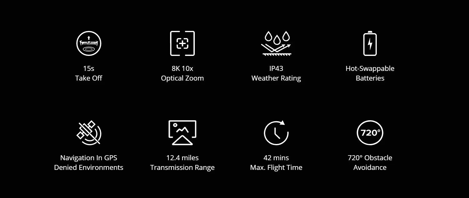
by AutelThe Autel EVO Max 4N is the next generation of intelligent, agile drones, equipped with 720-degree obstacle avoidance and A-Mesh 1.0 networking support. This commercial drone is designed for night operations, featuring starlight night vision, zoom, thermal cameras, and full laser ranging capabilities
- Ratenzahlung Sie können auf Raten mit den Visa, Visa Premium, Maestro, Master Card und Diners reditkarten zahlen. Die Gebühr beträgt 5% des offengelegenen Preises und wird im Warenkorb bei der Zahlungsauswahl gerechnet. Sie können mehr Details auf dem Link Zahlungsarten überprüfen.
- Schnelle Lieferung Für alle Lieferungen innerhalb Kroatiens, die bis 14.00 Uhr erhaltet werden, wird die Lieferung binnen einem Arbeitstag geliefert. Für die ganze Europa nehmen wir die schnelle Zustellung vor und mehr Details können Sie auf dem Link Lieferungsarten überprüfen.
- Internationaler Kauf Die EU-Firmen (außer die Republik Kroatien) zahlen den Preis ohne die Mehrwertsteuer mit dem gültigen VAT ID- Nummer. Der Preis wird bei Check-Out gerechnet. Alle Käufer außerhalb der Europäischen Union zahlen den Ausfuhrpreis ohne die Mehrwertsteuer.
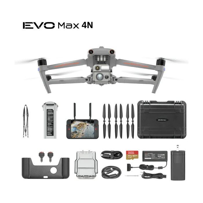
Paket beinhaltet
- Autel EVO MAX 4N
- Aircraft ( (Battery, propeller, gimbal,gimbal cover, 64G SD card included)
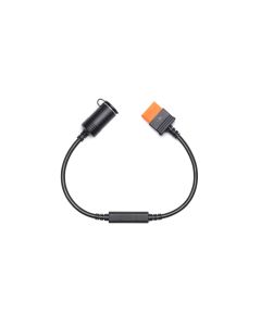
- Battery Charger + Power Cable
- Spare Propeller (pair)
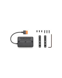
- 1 screwdriver
- Smart Controller V3(sticks included)
- Smart Controller Lanyard
- Smart Controller Cover
- Smart Controller Spare Joystick
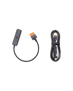
- RC Charger
- RC Charging Cable
- Data Cable
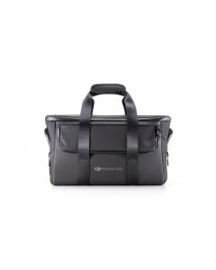
- Rugged Case
EVO MAX 4N --A Leader of Drone Intelligence
The EVO Max 4N brings powerful technologies and advanced autonomy to users. EVO Max 4N assesses complex environments to create real-time 3D flight paths for unparalleled obstacle avoidance.Advanced sensors make flight in GPS unavailable areas possible and the incredible new thermal payload unlocks new object identification and tracking scenarios.With a foldable, weather-resistant design, the EVO Max 4N is as portable as it is capable.
Autonomous Path Finding:Autel's Autonomy Engine collects surrounding environmental data and plans 3D flight paths through complex environments such as mountains, forests, and buildings. Use cases include rapid 3D scene reconstruction, public safety overwatch, industrial inspection, and land surveying.

Navigation in GPS Denied Environment: Advanced sensors allow the EVO Max 4N to navigate within hardened structures, underground, or in environments without GPS.
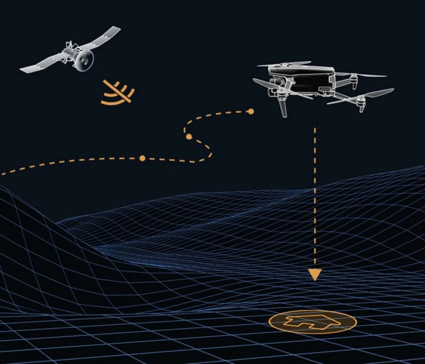
Accurate Object Identification and Tracking: Based on Autel's AI recognition technology, the EVO Max 4N can automatically identify and lock onto different types of targets such as heat sources, moving people, or vehicles and achieve high-altitude tracking and data collection for law enforcement.
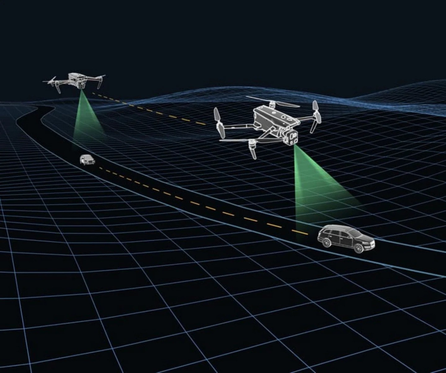
No Blind Spots-Ultimate Obstacle Avoidance
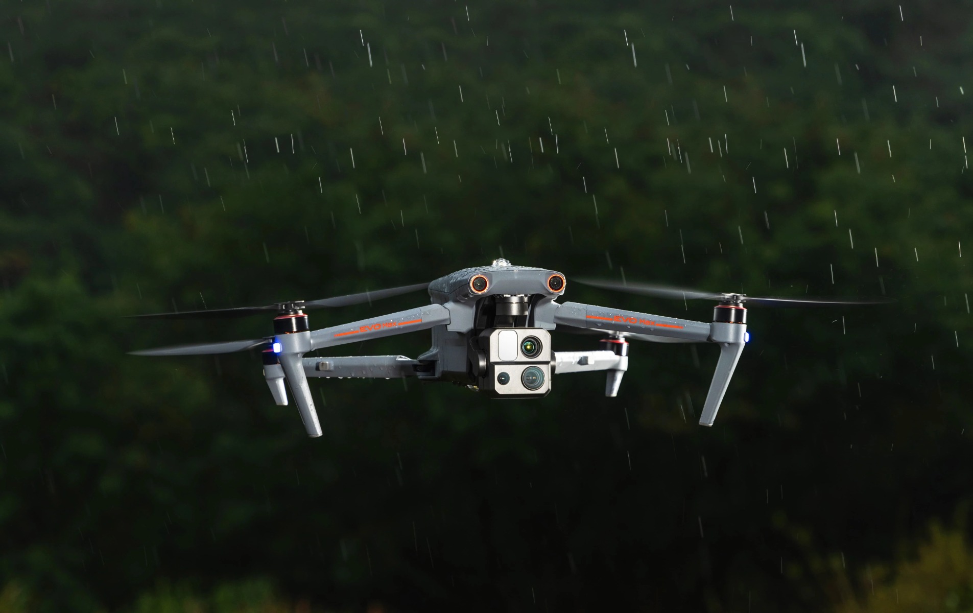
EVO Max 4N is the only commercial drone that combines traditional binocular vision systems with millimeter wave radar technology. This allows the EVO Max 4N's onboard Autel Autonomy Engine to perceive objects down to 0.5 inch, eliminating blind spots and enabling operation in low light or rainy conditions.
Anti Jam-Anti Interference
The EVO Max 4N uses advanced flight control modules and algorithms specially designed to counter RFI, EMI, and GPS spoofing. This enables the EVO Max 4N to fly confidently near power lines, critical structures, and in complex areas.
Weather Rating-IP43
A-Mesh 1.0 - The Drone Industry's First Mesh Networking Technology
EVO Max 4N features the new A-Mesh system, enabling drone-to-drone autonomous communication, connection, and collaboration.
Strong Anti-Interference: The EVO Max 4N can communicate seamlessly with other drones in the vicinity, unlike a traditional chain structure. If a single drone fails or exits unexpectedly, the entire system will independently self-organize and continue to relay critical information.
Beyond-Line-of-Sight Applications: With A-Mesh, multiple aircrafts in the vicinity can act as relay points to greatly improve BVLOS operation effectiveness
Full-Fleet Control: Multiple drones can be controlled autonomously by 1 pilot or by a group of pilots simultaneously with or without LTE coverage.
Enhanced Range: Communication nodes can be placed statically on hills or poles to provide full coverage to an area, or a swarm of drones can provide mobile communication points to extend the coverage of the entire group.
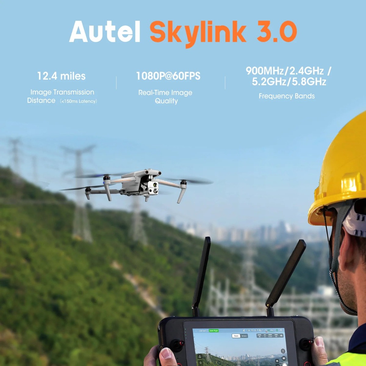
Autel SkyLink 3.0
The EVO Max 4N SkyLink 3.0 system comes with 6 antennas, 4 frequency bands, AES-256 encryption*, and optional 4G integration* to provide users with the most advanced flight capabilities ever in an EVO.
12.4 miles: Image Transmission Distance 1080p/60fps: Real-Time Image Quality
900MHz/2.4GHz/5.2GHz/5.8GHz** : Frequency Bands <150ms Latency
Mission Ready Payload
The payload integrates wide-angle camera, zoom camera, thermal camera and a laser rangefinder for all data capture needs and critical decision making.

Starlight Camera: Explore the Night, 2.3MP
LUX: 0.0001, ISO: 450000
Equivalent: 41.4 mm
Wide Camera: 50MP 1/1.28" CMOS Aperture: f/1.9 DFVO: 85° Equivalent: 23 mm
Thermal Camera: 640x512 Aperture: 13mm 16x Digital Zoom
Temperature Measurement Range: -20°C to 550°C
Laser Rangefinder: Measuring Range: 5 - 1200m
Measurement Accuracy: +1m
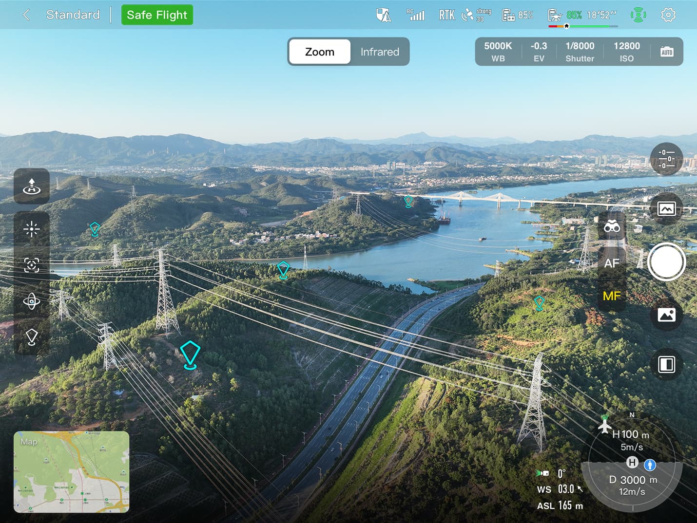
Autel Enterprise App Platform
The Autel Enterprise App is built from the ground up for industrial applications and features a brand-new interface for simple, efficient operation. Additional features and semi-autonomous modes maximize the EVO Max 4N's mission capability.
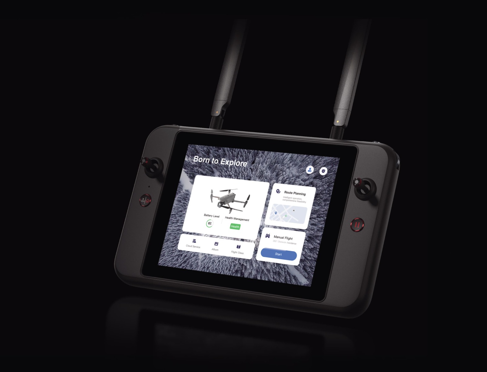
Smart Features
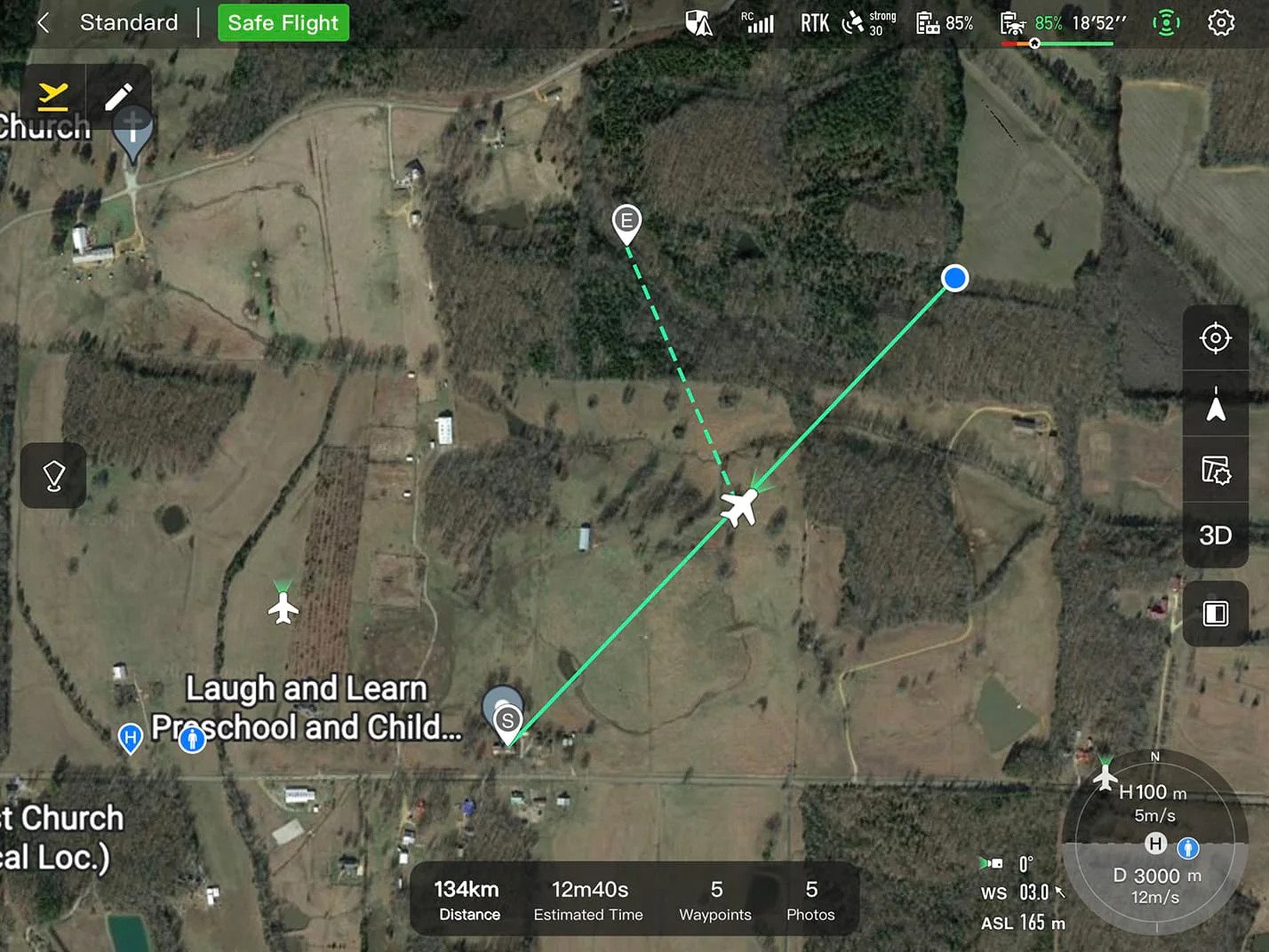
3D Map Planning: Plan, create, and execute 3D waypoint mission plan on a 3D map.

Quick Mission: Temporary quick missions can be created while executing other missions, and multiple sub-missions can be stacked for enhanced flexibility.
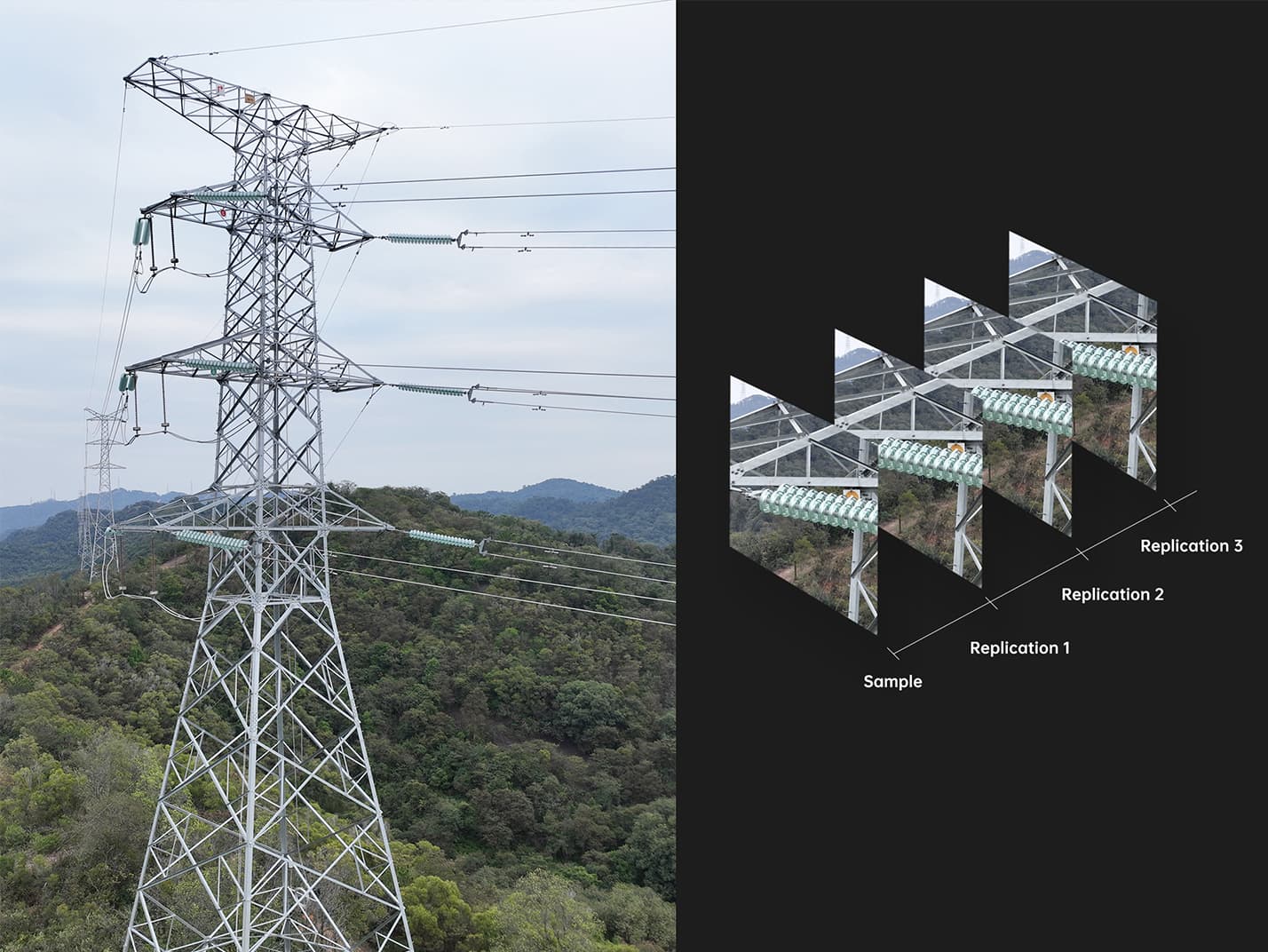
Mission Reproduction: With this feature activated, fly a manual or semi-autonomous mission, or string multiple missions together. The EVO Max4N will automatically record the camera angles and replicate the mission you just flew.
Multiple Mission Types
The Enterprise App provides various autonomous and semi autonomous mission planning for public safety, inspection, and surveying.
Terrain Follow: Maintain relatively constant altitude from the ground for uneven or sloped terrain.
Rectangular Mission: One-click automatic generation of a rectangular flight area.
Automatic Mission Generation And Data Capture: Automatically produce routes by adding regional boundary points through dots or importing KML files.
Waypoint Missions: Users can add waypointsfor flexible, non-structured flight paths.
Oblique Photography: Automatically plan 5 groups of routes (1 ortho + 4 oblique) according to the flight area set by the user.
Spiral Mission: Supports helical flight search in a designated area for SAR.
Vertical Scan:Perform vertical surveys for building facades, open pit walls, and towers. Corridor Mission:Supports intuitive and effective corridor mission planning for roads, rivers, pipelines, power lines and other narrow,large-scale terrain.
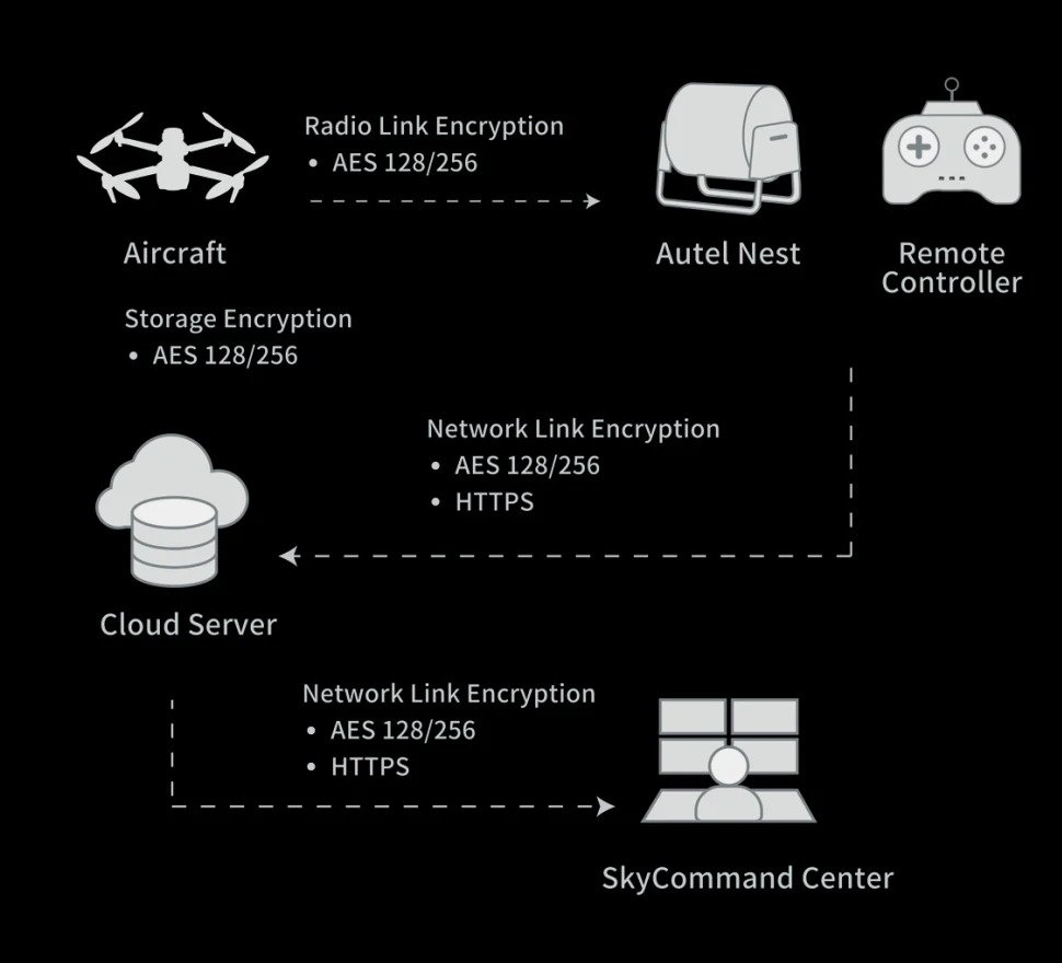
Data Security
Privacy Protection: Data involving user and aircraft information, including flight logs, locations,and account information can only be physically accessed via the aircraft locally.
Encrypted Data Storage: Supports AES-256 encryption for photos, videos, and flight logs, are password-protected.
Enhanced Live-View
Multi-channel Projection Screen: Supports simultaneous output of RGB, infrared, night vision, and wide-angle images.
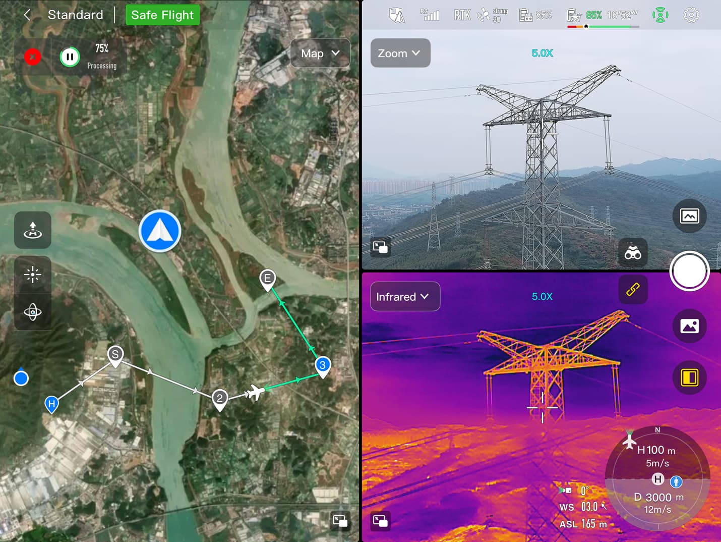
AR Scene: Geo-location data and other aircraft location info detected by ADS-B can overlay on real-time map, which is convenient for users to confirm the drone's location and avoid airborne risks.
Autel SDK
The Autel SDK is open to the world, helping developers and partners reduce software and hardware development costs and jointly create a new industry ecosystem. (Note: Only mobile SDK is availbel at this moment,other 2 not released yet)

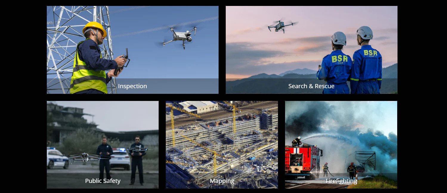
Widely Application
| Weight | 3.5 lbs (1600g, battery and gimbal included) |
| Max. Takeoff Weight | 4.41 lbs (1999 g) |
| Dimensions | 576*660*149 mm (folded, incl. propellers) |
| 340*407*148 mm (folded, excl. propellers) | |
| 257*136*133 mm (unfolded, excl. propellers) | |
| Diagonal Wheelbase | 1.52 ft (464mm) |
| Max Ascent Speed | 8m/s |
| Max Descent Speed | 6m/s |
| Max Horizontal Speed (windless near sea level) | 23m/s |
| *Maximum speed in Ludicrous Mode is 19m/s when operating in EU regions. | |
| Max Service Ceiling Above Sea Level | 23000ft (7000m) |
| Max Flight Time (windless) | 42 mins |
| Max Hovering Time (windless) | 38 mins |
| Max Wind Resistance | 27mph* |
| *Takeoff and landing can withstand wind speeds up to 27 mph (12 m/s). | |
| IP Rating | IP43 |
| Max Tilt Angle | 35° |
| Max Angular Velocity | Pitch: 300°/s; Yaw: 120°/s |
| Operating Temperature | -4°F to 122°F (-20℃ - 50℃) |
| Operating Frequency | 2.4G/5.2G*/5.8G/900MHz* |
| GNSS | |
| GPS+Galileo+BeiDou+GLONASS | |
| Transmitter Power (EIRP) | 2.4GHz:<33dBm(FCC), <20dBm(CE/SRRC/MIC) |
| 5.8GHz:<33dBm(FCC), <30dBm(SRRC), <14dBm(CE) | |
| 5.15-5.25GHz: < 23dBm(FCC/SRRC/MIC) | |
| 5.25-5.35GHz:<30dBm(FCC), <23dBm(SRRC/MIC) | |
| Hovering Accuracy | Vertical: |
| ±0.1 m (Vision System enabled); | |
| ±0.3 m (GPS enabled); | |
| ±0.15 m (RTK enabled); | |
| Horizontal: | |
| ±0.15 m (Vision System enabled); | |
| ±0.3 m (GPS enabled); | |
| ±0.1 m (RTK enabled); | |
| Gimbal | |
| Mechanical Range | Pan: -135° to 45° |
| Tilt: -45° to 45° | |
| Roll: -45° to 45° | |
| Controllable Range | -90° to 30° |
| Stable system | 3-axis mechanical gimbal (pan, tilt, roll) |
| Max Control Speed (pitch) | 200º/s |
| Angular Vibration Range | <0.005° |
| Zoom Camera (Telephoto) | |
| Sensor | 1/2" CMOS, Effective pixels: 48M |
| Lens | Focal length: 11.8-43.3mm (35mm, equivalent: 64-234mm) |
| Aperture: f/2.8-f/4.8 | |
| Exposure Compensation | ±3EV 0.3EV/step |
| ISO Range | Normal Mode: |
| Auto: ISO100 ~ ISO6400 | |
| Manual: | |
| Photo: ISO100 ~ ISO12800 | |
| Video: ISO100 ~ ISO6400 | |
| Shutter Speed | Photo: 8s ~ 1/8000s |
| Video: 1s ~ 1/8000s | |
| Max Photo Size | 8000×6000 |
| Max Video Resolution | 7680×4320 |
| Wide Camera | |
| Sensor | 1/1.28 CMOS, Effective pixels: 50M |
| Lens | DFOV: 85° |
| Focal length: 4.5 mm (equivalent: 23 mm) | |
| Aperture: f/1.9 | |
| AF motor: 8-wire SMA, PDAF focus | |
| Exposure Compensation | ±3EV 0.3EV/step |
| ISO Range | Auto: |
| Photo: ISO100~ISO6400 | |
| Video: ISO100~ISO64000 (Night scene mode: up to ISO64000) | |
| Manual: | |
| Photo: ISO100~ISO12800 | |
| Video: ISO100~ISO6400 | |
| Shutter Speed | Photo: 8s ~ 1/8000s |
| Video: 1s ~ 1/8000s | |
| Max. Video Resolution | 3840×2160 |
| Photo Size | 8192*6144 |
| 4096*3072 | |
| Thermal Camera | |
| Thermal Imager | Uncooled VOx Microbolometer |
| Lens | DFOV: 42° IFOV: 0.92mrad |
| Aperture: 13mm | |
| Focus: f/1.2 | |
| Infrared Temperature Measurement | |
| Accuracy | 26.6~37.4 ℉ or reading ±3% (using |
| the larger value) @ambient | |
| temperature -4℉ to 140℉ | |
| Video Resolution | 640*512 |
| Photo Size | 640*512 |
| Pixel Pitch | 12 um |
| Temperature Measurement Method | Center measurement, pot measurement, rectangular measurement |
| Temperature Measurement Range | -4℉ to 302℉, 32℉ to 1022℉ (-20°C to 150°C, 0 to 550°C) |
| Temperature Alert | High and low temperature alarm thresholds, reporting coordinates and temperature values |
| Laser Range Finder | |
| Measurement Accuracy | ±3.3ft (1m) |
| Measuring Range | 3937ft (1200m) |
| Image Transmission | |
| Operating Frequency | 2.4G/5.2G*/5.8G/900MHz* |
| *5.2GHz is only applicable for FCC, CE, and UKCA regions. 900MHz is only applicable for FCC regions. | |
| Max Transmission Distance | |
| (unobstructed, free of interference) | 12.4 miles/20km (FCC), 4.9 miles/8km (CE) |
| Independent Networking | Autel Smart Controller V3 |
| Transmitter Power (EIRP) | 2.4GHz:<33dBm(FCC), <20dBm(CE/SRRC/MIC) |
| 5.8GHz:<33dBm(FCC), <30dBm(SRRC), <14dBm(CE) | |
| 5.15-5.25GHz: < 23dBm(FCC/SRRC/MIC) | |
| 5.25-5.35GHz:<30dBm(FCC), <23dBm(SRRC/MIC) | |
| Autonomy | |
| Non-GPS Hovering and Manual Flight | Indoor: Horizontal error ≤1.18in (At least have texture at one direction) |
| Outdoor: | |
| Daytime: Within 1640ft (500m) flight height, horizontal error < 0.01*height | |
| Night: Manual flight is controllable within 328ft (100m) flight height | |
| Non-GPS Return-to-Home | Within 1640ft (500m) flight height, horizontal error of Return-to-Home point < 11.81in |
| Automatic Obstacle Rerouting | High Speed Obstacle Rerouting: Flight speed up to 45mph (20m/s) when Min. safety distance to obstacle is 4.9ft (1.5m) |
| High Precision Obstacle Rerouting: Flight speed could reach 6.7mph (3m/s) when Min. safety distance to obstacle is 1.64ft (0.5m) | |
| Multi-target Recognition and Tracking | Target identification types: people, vehicles, boats |
| Number of targets detected: 64 | |
| Comprehensive recognition accuracy: > 85% | |
| Millimeter-wave Radar Sensing System | |
| Frequency | 60Ghz~64Ghz* |
| *Please fly safely and consult your local laws and regulations. | |
| Size | 1.5*0.55*0.08 in (38*14*2mm) (L*W*H) |
| Weight | 0.07oz (2g) |
| EIRP | 18dBm |
| Sensing Range | Upward: 5.9~787.4in (0.15~20m) |
| Downward: 3.9~4724.4in(0.1~120m) | |
| Forward and Backward (Standard/Comfortable): 0.82~98.43ft (0.25~30m) | |
| Forward and Backward(Ludicrous): 1.64~196.85ft (0.5~60m) | |
| FOV | Horizontal(6dB):±60°,Vertical(6dB):±30° |
| Speed Measurement Range | ± 134mph (60m/s) |
- Neu
- Neu